
Hoskote Direction from Whitefield
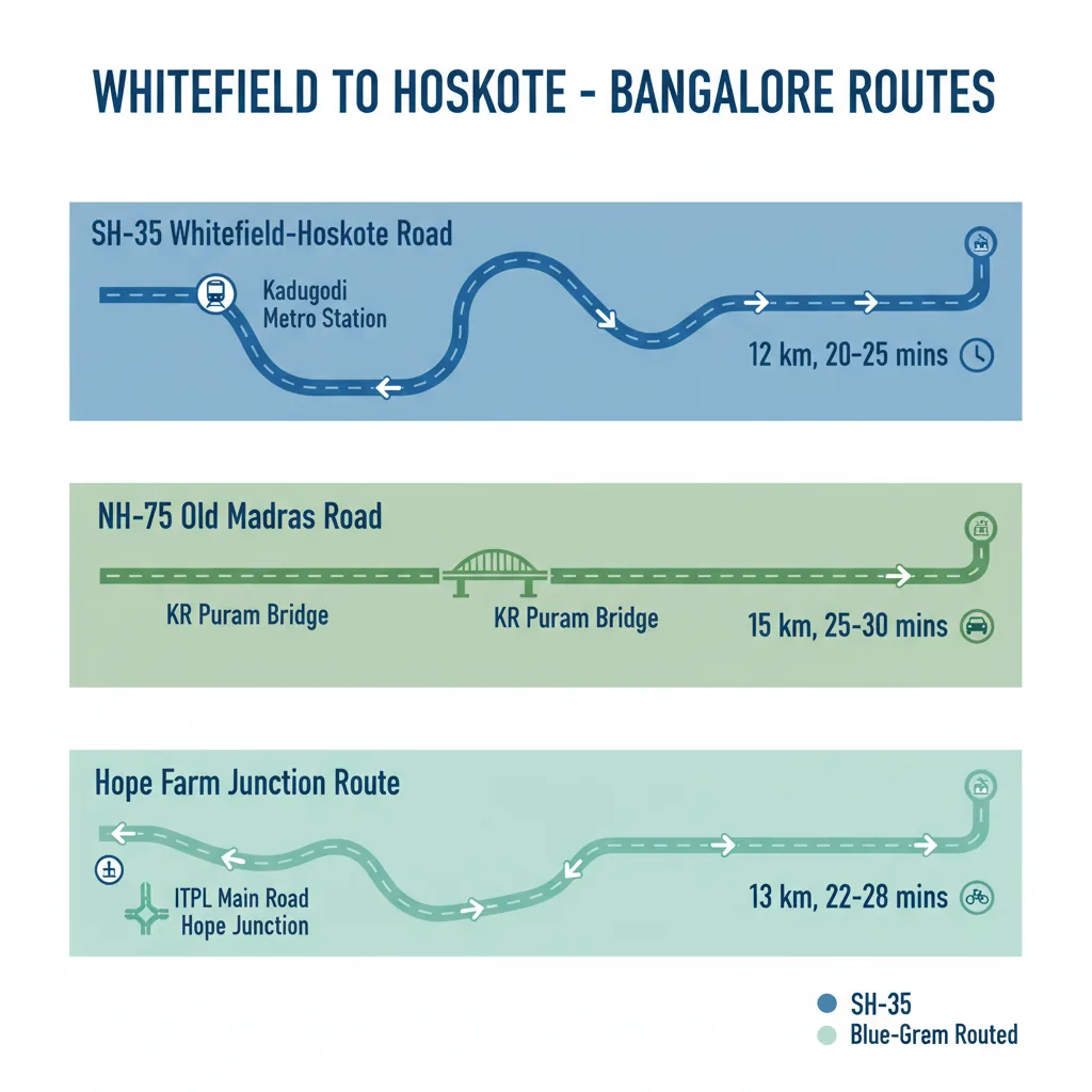
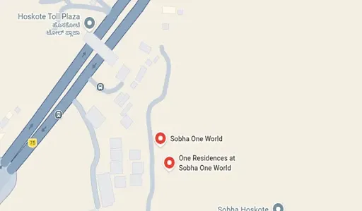
Driving in the Hoskote direction from Whitefield primarily follows State Highway 35 (SH-35), also widely known as the Whitefield-Hoskote Main Road, moving directly North-East for a smooth commute of 12 to 15 kilometers. For IT professionals and property buyers looking to escape inner-city congestion, this expanding transit belt bridges Bangalore's technology core with its fastest-growing suburban micro-market. Traveling in this direction takes just 20 to 30 minutes, cleanly bypassing major inner-city bottlenecks and leading right to massive upcoming destination townships like the 300-acre Sobha One World development at the Hoskote toll gateway.
Detailed Breakdown of Routes from Whitefield to Hoskote
When navigating in the Hoskote direction from core Whitefield hubs like ITPL or Hope Farm Junction, commuters have two distinct, high-quality road options depending on their starting coordinates:
Route 1: The Direct Whitefield-Hoskote Main Road (SH-35)
This is the most popular, straightforward corridor utilized by everyday office commuters heading north.
- The Path: Start at Hope Farm Junction then Head North past the Whitefield (Kadugodi) Metro Station. Cross the Kadugodi railway flyover. After that, continue straight along SH-35 through Kannamangala and Seegehalli. Merge smoothly near the Hoskote town entrance.
- Travel Parameters: Exactly 12.3 Kilometers from gate to gate, requiring a driving window of 20 to 25 minutes under standard morning rush conditions.
Route 2: The Extended NH-75 Link via Outer Ring Road
Best suited for heavy vehicles, commercial transport, or travelers starting from Western Whitefield (Hoodi / Mahadevapura area).
- The Path: Head Northwest toward the K.R. Puram suspension bridge. Then take a sharp right turn to merge onto the massive 6-lane Old Madras Road (NH-75) highway. Drive straight past Avalahalli and the MVJ Medical College to enter the township.
- Travel Parameters: Approximately 15 to 17 Kilometers, translating to a drive time of 25 to 35 minutes thanks to the higher legal speed limits allowed on the national highway grid.
Technical Commute Parameters & Distance Matrix
To assist real estate investors analyzing this corridor's accessibility, the operational data points below map out the current transit ecosystem:
| Commute Metric | Measured Driving Data Points | Primary Route Corridor Used |
|---|---|---|
| Total Distance Layer | 12 to 15 Kilometers | Varies slightly based on local sub-lanes |
| Private Car / Cab Time | 20 Minutes (Off-Peak) | Via direct Whitefield-Hoskote Road (SH-35) |
| BMTC Bus Commute Time | 35 to 45 Minutes | Utilizing dedicated direct bus lines |
| Time to Nearest Metro Hub | 15 to 17 Minutes | Smooth straight run down to Kadugodi |
Public Transport Options & Last-Mile Connectivity
Commuting in the Hoskote direction from Whitefield does not require relying solely on private ownership. The state infrastructure offers multiple overlapping transit layers:
- Namma Metro Lifeline: The active Purple Line Terminal at Whitefield (Kadugodi) serves as the primary mass-transit anchor. Commuters can comfortably step off the metro coach and complete the final leg of their journey via a quick 15-minute cab or auto-rickshaw ride.
- Direct BMTC Bus Fleets: The Bangalore Metropolitan Transport Corporation runs highly reliable scheduled schedules directly along this line. Commuters can look for the 335-EK AC Volvo services or the 328-H and 398-H bus series, which offer smooth transportation between the Whitefield Post Office area and the Hoskote High School junctions.




 24/7 Support
 Free Site Visit
 Unmatched Price